Protection, Kansas Weather
Issued: 6:30 pm CDT Apr 18, 2024 Latitude: 37.2014145 Longitude: -99.4840075 View on Google Maps
|
|
|
|
|
|
|
|
|
|
 |
 |
 |
 |
 |
 |
|
 |
| Low: °F |
High: °F |
High: °F |
High: °F |
High: °F |
High: °F |
High: °F |
High: °F |
| Low: °F |
Low: °F |
Low: °F |
Low: °F |
Low: °F |
Low: °F |
|
| Increasing Clouds |
Mostly Cloudy |
Rain |
Partly Sunny |
Sunny |
Mostly Sunny |
Partly Sunny |
Thunderstorms |
Current Conditions at
DODGE CITY - (KDDC)
57°
Clear
as of 6:52 PM CDST
Rel. Humidity: 33%
Dew Point: 28°F
Visibility: 10 Miles
Pressure: 30.14 in.
Flight Rule: VFR
Wind Data
23 MPH
030° Northeast
Cloud Level(s): Clear
Current Conditions at
MEDICINE LAKE - (KP28)
63°
Clear
as of 6:56 PM CDST
Rel. Humidity: 33%
Dew Point: 34°F
Pressure: 30.09 in.
Wind Data
18 MPH
Gust: 31 MPH
030° Northeast
Current Conditions at
WEST WOODWARD - (KWWR)
57°
Clear
as of 7:30 PM CDST
Rel. Humidity: 41%
Dew Point: 34°F
Visibility: 10 Miles
Pressure: 30.15 in.
Flight Rule: VFR
Wind Data
13 MPH
Gust: 20 MPH
030° Northeast
Cloud Level(s): Clear
Current Conditions at
PRATT - (KPTT)
59°
Clear
as of 7:30 PM CDST
Rel. Humidity: 28%
Dew Point: 27°F
Visibility: 10 Miles
Pressure: 30.13 in.
Flight Rule: VFR
Wind Data
21 MPH
Gust: 25 MPH
020° North
Cloud Level(s): Clear
|
Tonight... Increasing clouds, with a low around 39. North northeast wind 7 to 10 mph. |
|
|
Friday... Mostly cloudy, with a high near 63. Light and variable wind becoming east southeast 6 to 11 mph in the morning. |
|
 |
Friday Night... A 30 percent chance of showers, mainly after 9pm. Partly cloudy, with a low around 39. East northeast wind 7 to 10 mph. |
|
|
Saturday... A 40 percent chance of showers, mainly before 1pm. Mostly cloudy, with a high near 54. East northeast wind 9 to 13 mph. |
|
 |
Saturday Night... A 20 percent chance of showers. Mostly cloudy, with a low around 38. Northeast wind 5 to 10 mph. |
|
|
Sunday... Partly sunny, with a high near 61. |
|
 |
Sunday Night... Mostly clear, with a low around 41. |
|
|
Monday... Sunny, with a high near 80. Breezy. |
|
 |
Monday Night... A 40 percent chance of showers and thunderstorms, mainly before 1am. Partly cloudy, with a low around 49. Breezy. |
|
|
Tuesday... Mostly sunny, with a high near 73. |
|
 |
Tuesday Night... A 20 percent chance of showers. Partly cloudy, with a low around 45. |
|
|
Wednesday... A 20 percent chance of showers. Partly sunny, with a high near 73. |
|
 |
Wednesday Night... A 30 percent chance of showers and thunderstorms. Mostly cloudy, with a low around 53. |
|
|
Thursday... A 30 percent chance of showers and thunderstorms. Partly sunny, with a high near 81. Breezy. |
|
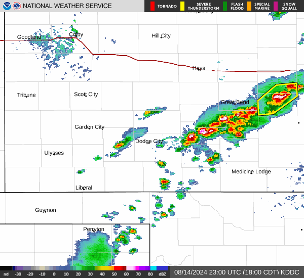
Current Radar Image
Sun Almanac for Protection, Kansas
Sunrise: 06:58 AM
Sunset: 8:16 PM
Civil Sunrise:06:31 AM
Civil Sunset: 8:43 PM
Nautical Sunrise: 05:59 AM
Nautical Sunset: 9:16 PM
Astro Sunrise: 05:25 AM
Astro Sunset: 9:49 PM
Kansas' Current Temperatures
 Kansas' Satellite Image
 Kansas' Current Wind Direction
| National Summary |
of upper and lower values of current conditions amongst 6376 locations
in the contiguous United States |
|
High
Temp |
99° |
Junction, Texas
|
|
Low
Temp |
18° |
Perryton, Texas
|
|
Wind
Speed |
40mph |
Salida Mountain, Colorado
|
|
Wind
Gust |
51mph |
Salida Mountain, Colorado
|
|
Wind
Chill |
4° |
Perryton, Texas
|
|
Heat
Index |
100° |
Del Rio, Texas
|
|
High
Pressure |
30.34Hg |
Cutbank, Montana
and 1 other location
|
|
Low
Pressure |
29.75Hg |
Bullhead City, Arizona
|
|
| # Locations Reporting Snow |
12 |
|
| # Locations Reporting Rain |
67 |
|
| # Locations Reporting Thunderstorms / Lightning |
10 |
|
| Average Temperature in the Contiguous USA |
61° |
|
Any use of the information on this page is at your own risk. This information should not be relied upon in life-threatening situations, potential financial loss situations or in lieu of any officially disseminated information. Visit the
National Weather Service for official information.