Pfeiffer, Arkansas Weather
Issued: 8:36 am CDT Apr 20, 2024 Latitude: 35.8239644 Longitude: -91.5879156 View on Google Maps
|
|
|
|
|
|
|
|
|
|
 |
 |
 |
|
|
 |
|
 |
| High: °F |
Low: °F |
High: °F |
High: °F |
High: °F |
High: °F |
High: °F |
High: °F |
| Low: °F |
Low: °F |
Low: °F |
Low: °F |
Low: °F |
|
| Thunderstorms |
Rain |
Sunny |
Sunny |
Sunny |
Rain |
Thunderstorms |
Thunderstorms |
Current Conditions at
BATESVILLE - (KBVX)
48°
Partly Cloudy
as of 7:56 AM CDST
Rel. Humidity: 100%
Dew Point: 48°F
Visibility: 10 Miles
Pressure: 30.30 in.
Flight Rule: VFR
Wind Data
3 MPH
050° Northeast
Cloud Level(s): Few at 9500ft, Scattered at 12000ft
Current Conditions at
WALNUT RIDGE - (KARG)
52°
Cloudy
as of 7:56 AM CDST
Rel. Humidity: 76%
Dew Point: 45°F
Visibility: 10 Miles
Pressure: 30.29 in.
Flight Rule: VFR
Cloud Level(s): Solid Overcast at 9500ft
Current Conditions at
SEARCY MUNICIPAL AIRPORT - (KSRC)
52°
Cloudy
as of 8:27 AM CDST
Rel. Humidity: 66%
Dew Point: 41°F
Visibility: 10 Miles
Pressure: 30.29 in.
Flight Rule: VFR
Wind Data
12 MPH
040° Northeast
Cloud Level(s): Solid Overcast at 7500ft
Current Conditions at
JONESBORO - (KJBR)
52°
Cloudy
as of 7:53 AM CDST
Rel. Humidity: 76%
Dew Point: 45°F
Visibility: 10 Miles
Pressure: 30.29 in.
Flight Rule: VFR
Cloud Level(s): Solid Overcast at 9000ft
|
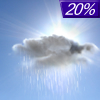
Today... A 20 percent chance of showers and thunderstorms before 10am. Partly sunny, with a high near 64. Northeast wind 5 to 10 mph, with gusts as high as 15 mph. |
|
|
Tonight... A 20 percent chance of showers before midnight. Cloudy, then gradually becoming partly cloudy, with a low around 44. North wind 5 to 10 mph. |
|
|
Sunday... Sunny, with a high near 65. North northeast wind 5 to 10 mph. |
|
 |
Sunday Night... Mostly clear, with a low around 39. North northwest wind around 5 mph becoming calm after midnight. |
|
|
Monday... Sunny, with a high near 70. Calm wind becoming south around 5 mph in the morning. |
|
 |
Monday Night... Clear, with a low around 46. South wind around 10 mph, with gusts as high as 15 mph. |
|
|
Tuesday... Sunny, with a high near 74. South southwest wind around 15 mph, with gusts as high as 25 mph. |
|
 |
Tuesday Night... Partly cloudy, with a low around 52. Southwest wind 10 to 15 mph becoming northwest after midnight. Winds could gust as high as 20 mph. |
|
|
Wednesday... A 20 percent chance of showers after 1pm. Mostly sunny, with a high near 73. North wind around 10 mph becoming east northeast in the afternoon. Winds could gust as high as 15 mph. |
|
 |
Wednesday Night... A 30 percent chance of showers and thunderstorms, mainly after 1am. Partly cloudy, with a low around 49. |
|
|
Thursday... A 20 percent chance of showers and thunderstorms. Partly sunny, with a high near 69. |
|
 |
Thursday Night... A 30 percent chance of showers and thunderstorms. Mostly cloudy, with a low around 56. |
|
|
Friday... A 30 percent chance of showers and thunderstorms. Mostly cloudy, with a high near 78. |
|
Current Radar Image
Sun Almanac for Pfeiffer, Arkansas
Sunrise: 06:26 AM
Sunset: 7:44 PM
Civil Sunrise:05:59 AM
Civil Sunset: 8:11 PM
Nautical Sunrise: 05:27 AM
Nautical Sunset: 8:43 PM
Astro Sunrise: 04:54 AM
Astro Sunset: 9:16 PM
Arkansas' Current Temperatures
 Arkansas' Satellite Image
 Arkansas' Current Wind Direction
| National Summary |
of upper and lower values of current conditions amongst 7200 locations
in the contiguous United States |
|
High
Temp |
81° |
Fort Lauderdale Intl, Florida
and 4 other locations
|
|
Low
Temp |
-15° |
Front Royal, Virginia
|
|
Wind
Speed |
29mph |
Iowa Falls Municipal A/P, Iowa
|
|
Wind
Gust |
37mph |
Iowa Falls Municipal A/P, Iowa
|
|
Wind
Chill |
-16° |
Perryton, Texas
|
|
High
Pressure |
30.46Hg |
Hebron, Nebraska
and 3 other locations
|
|
Low
Pressure |
29.77Hg |
Frenchville, Maine
|
|
| # Locations Reporting Snow |
34 |
|
| # Locations Reporting Rain |
114 |
|
| # Locations Reporting Thunderstorms / Lightning |
13 |
|
| # Locations Reporting Fog |
11 |
|
| Average Temperature in the Contiguous USA |
49° |
|
Any use of the information on this page is at your own risk. This information should not be relied upon in life-threatening situations, potential financial loss situations or in lieu of any officially disseminated information. Visit the
National Weather Service for official information.


