Peyton, Wisconsin Weather
Issued: 4:27 am CDT Apr 16, 2024 Latitude: 46.6502178 Longitude: -92.0213014 View on Google Maps
|
|
|
|
|
|
|
|
|
|
 |
 |
 |
 |
 |
 |
 |
 |
| High: °F |
Low: °F |
High: °F |
High: °F |
High: °F |
High: °F |
High: °F |
High: °F |
| Low: °F |
Low: °F |
Low: °F |
Low: °F |
Low: °F |
|
| Rain |
Rain |
Rain |
Rain |
Rain |
Mostly Sunny |
Sunny |
Rain |
Current Conditions at
SUPERIOR - (KSUW)
Clear
as of 4:35 AM CDST
Rel. Humidity: 80%
Dew Point: 34°F
Visibility: 10 Miles
Pressure: 30.03 in.
Flight Rule: VFR
Wind Data
10 MPH
Gust: 18 MPH
060° Northeast
Cloud Level(s): Clear
Current Conditions at
DULUTH SKY HARBOR - (KDYT)
Clear
as of 4:35 AM CDST
Rel. Humidity: 93%
Dew Point: 37°F
Visibility: 10 Miles
Pressure: 30.04 in.
Flight Rule: VFR
Wind Data
24 MPH
Gust: 30 MPH
050° Northeast
Cloud Level(s): Clear
Current Conditions at
DULUTH INTL - (KDLH)
Mostly Clear
as of 3:55 AM CDST
Rel. Humidity: 45%
Dew Point: 25°F
Visibility: 10 Miles
Pressure: 30.01 in.
Flight Rule: VFR
Cloud Level(s): Few at 11000ft
Current Conditions at
CLOQUET - (KCOQ)
45°
Clear
as of 4:35 AM CDST
Rel. Humidity: 39%
Dew Point: 21°F
Visibility: 10 Miles
Pressure: 30.01 in.
Flight Rule: VFR
Cloud Level(s): Clear
|
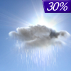
Today... A 30 percent chance of showers, mainly after 5pm. Mostly cloudy, with a high near 51. Windy, with a northeast wind 10 to 15 mph increasing to 20 to 25 mph in the afternoon. Winds could gust as high as 35 mph. |
|
|
Tonight... Showers. Low around 37. Windy, with a northeast wind 20 to 25 mph, with gusts as high as 35 mph. Chance of precipitation is 100%. New precipitation amounts between a half and three quarters of an inch possible. |
|
|
Wednesday... Showers. Steady temperature around 39. Breezy, with a northeast wind 10 to 20 mph, with gusts as high as 30 mph. Chance of precipitation is 90%. New precipitation amounts between a tenth and quarter of an inch possible. |
|
 |
Wednesday Night... A 30 percent chance of showers before 1am. Cloudy, then gradually becoming partly cloudy, with a low around 37. West wind around 10 mph, with gusts as high as 15 mph. |
|
|
Thursday... A 20 percent chance of showers after 1pm. Mostly sunny, with a high near 54. Breezy, with a west wind 10 to 15 mph, with gusts as high as 25 mph. |
|
 |
Thursday Night... Partly cloudy, with a low around 32. Breezy, with a west wind around 15 mph, with gusts as high as 25 mph. |
|
|
Friday... A chance of rain, mainly after 1pm. Partly sunny, with a high near 45. Breezy, with a west wind 15 to 20 mph, with gusts as high as 30 mph. |
|
 |
Friday Night... Mostly cloudy, with a low around 30. Breezy, with a west wind 15 to 20 mph, with gusts as high as 30 mph. |
|
|
Saturday... Mostly sunny, with a high near 48. Breezy, with a northwest wind around 15 mph, with gusts as high as 25 mph. |
|
 |
Saturday Night... Mostly clear, with a low around 29. Blustery, with a west wind 10 to 15 mph, with gusts as high as 20 mph. |
|
|
Sunday... Sunny, with a high near 55. Breezy, with a west wind 10 to 15 mph, with gusts as high as 20 mph. |
|
|
Sunday Night... Mostly clear, with a low around 36. Breezy, with a southwest wind 10 to 15 mph, with gusts as high as 20 mph. |
|
|
Monday... A slight chance of rain. Mostly sunny, with a high near 58. Breezy, with a southwest wind around 15 mph, with gusts as high as 25 mph. |
|
Current Radar Image
Sun Almanac for Peyton, Wisconsin
Sunrise: 06:17 AM
Sunset: 7:58 PM
Civil Sunrise:05:46 AM
Civil Sunset: 8:30 PM
Nautical Sunrise: 05:07 AM
Nautical Sunset: 9:09 PM
Astro Sunrise: 04:24 AM
Astro Sunset: 9:51 PM
Wisconsin's Current Temperatures
 Wisconsin's Satellite Image
 Wisconsin's Current Wind Direction
| National Summary |
of upper and lower values of current conditions amongst 7040 locations
in the contiguous United States |
|
High
Temp |
79° |
Corpus Christi NAS, Texas
|
|
Low
Temp |
9° |
Perryton, Texas
|
|
Wind
Speed |
37mph |
Mitchell, South Dakota
and 1 other location
|
|
Wind
Gust |
60mph |
Aberdeen, South Dakota
|
|
Wind
Chill |
-8° |
Perryton, Texas
|
|
High
Pressure |
30.42Hg |
Newport, Oregon
and 1 other location
|
|
Low
Pressure |
29.31Hg |
Brewster Field, Nebraska
and 1 other location
|
|
| # Locations Reporting Snow |
8 |
|
| # Locations Reporting Rain |
83 |
|
| # Locations Reporting Thunderstorms / Lightning |
13 |
|
| # Locations Reporting Fog |
10 |
|
| Average Temperature in the Contiguous USA |
54° |
|
Any use of the information on this page is at your own risk. This information should not be relied upon in life-threatening situations, potential financial loss situations or in lieu of any officially disseminated information. Visit the
National Weather Service for official information.


