Murke, Wyoming Weather
your sport, your way
Air Sports Net on FacebookAir Sports Net on Google +Air Sports Net on TwitterReceive RSS UpdatesReceive Email Updates

Change location by the zip code or city,state: or search for other weather forecast locations in Wyoming by name.
Weather Forecast for Murke, Wyoming : Laramie County
Issued: 2:01 am MDT Apr 20, 2024 Latitude: 41.4247004 Longitude: -105.2152566 View on Google Maps

MouseOver for Detail Forecast
Today Tonight Sunday Monday Tuesday Wednesday Thursday Friday
20% chance of freezing drizzle on Today Patchy Fog on Tonight Sunny on Sunday 30% chance of rain on Monday Mostly Sunny on Tuesday 20% chance of thunderstorms on Wednesday 20% chance of  on Thursday Thunderstorms on Friday
High: 35°F Low: 27°F High: 60°F High: 64°F High: 57°F High: 69°F High: 68°F High: 60°F
Low: 40°F Low: 31°F Low: 39°F Low: 43°F Low: 42°F  
Freezing Drizzle Patchy Fog Sunny Rain Mostly Sunny Thunderstorms Partly Sunny Thunderstorms
-
Current Conditions at
LARAMIE - (KLAR)
27°
Feels like 13°F
Cloudy
as of 7:34 AM MDST
Rel. Humidity: 73%
Dew Point: 19°F
Visibility: 10 Miles
Pressure: 30.18 in.
Flight Rule: VFR
Wind Data
20 MPH
150° Southeast
Cloud Level(s): Scattered at 2800ft, Broken at 6000ft, Solid Overcast at 7500ft
Current Conditions at
CHEYENNE - (KCYS)
25°
Cloudy
Light Snow Mist
as of 7:36 AM MDST
Rel. Humidity: 85%
Dew Point: 21°F
Visibility: 1 Miles
Pressure: 30.28 in.
Flight Rule: IFR
Wind Data
7 MPH
090° East
Cloud Level(s): Scattered at 900ft, Scattered at 1400ft, Solid Overcast at 2300ft
Current Conditions at
FT COLLINS - (KFNL)
30°
Cloudy
Light Snow Mist
as of 7:41 AM MDST
Rel. Humidity: 100%
Dew Point: 30°F
Visibility: 2 Miles
Pressure: 30.32 in.
Flight Rule: IFR
Wind Data
8 MPH
130° Southeast
Cloud Level(s): Broken at 500ft, Solid Overcast at 2000ft
Current Conditions at
CONVERSE COUNTY ARPT - (KDGW)
19°
Clear
as of 6:53 AM MDST
Rel. Humidity: 92%
Dew Point: 18°F
Visibility: 10 Miles
Pressure: 30.33 in.
Flight Rule: VFR
Wind Data
6 MPH
110° East
Cloud Level(s): Clear
20% chance of freezing drizzle Today 
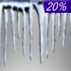
Today... A chance of freezing drizzle before 3pm, then a slight chance of snow. Areas of fog before noon. Otherwise, mostly cloudy, with a high near 35. Southeast wind around 10 mph. Chance of precipitation is 20%.

Patchy Fog on Tonight Tonight... Patchy fog after 9pm. Otherwise, mostly cloudy, with a low around 27. East southeast wind around 5 mph becoming west southwest after midnight.

Sunny on Sunday Sunday... Sunny, with a high near 60. West wind 5 to 10 mph increasing to 10 to 15 mph in the afternoon.

Cloudy on Sunday Night Sunday Night... Partly cloudy, with a low around 40. West wind around 15 mph.

30% chance of rain Monday Monday... A 30 percent chance of showers after noon. Mostly sunny, with a high near 64. Breezy, with a west northwest wind 15 to 20 mph increasing to 20 to 25 mph in the afternoon. Winds could gust as high as 40 mph.

Cloudy on Monday Night Monday Night... Partly cloudy, with a low around 31. Blustery.

Mostly Sunny on Tuesday Tuesday... Mostly sunny, with a high near 57. Breezy.

20% chance of rain Tuesday Night Tuesday Night... A chance of showers before midnight. Mostly cloudy, with a low around 39. Breezy.

20% chance of thunderstorms Wednesday Wednesday... A chance of showers and thunderstorms after noon. Partly sunny, with a high near 69.

10% chance of rain Wednesday Night Wednesday Night... A slight chance of showers before midnight. Partly cloudy, with a low around 43.

20% chance of  Thursday Thursday... A chance of showers. Partly sunny, with a high near 68. Breezy.

20% chance of rain Thursday Night Thursday Night... A chance of showers. Mostly cloudy, with a low around 42. Breezy.

Thunderstorms on Friday Friday... Showers likely and possibly a thunderstorm. Mostly cloudy, with a high near 60. Breezy.

Current Radar Image


Sun Almanac for Murke, Wyoming
Sunrise: 06:12 AM
Sunset: 7:47 PM
Civil Sunrise:05:43 AM
Civil Sunset: 8:16 PM
Nautical Sunrise: 05:08 AM
Nautical Sunset: 8:52 PM
Astro Sunrise: 04:30 AM
Astro Sunset: 9:29 PM
Any use of the information on this page is at your own risk. This information should not be relied upon in life-threatening situations, potential financial loss situations or in lieu of any officially disseminated information. Visit the National Weather Service for official information.