Luther, Texas Weather
your sport, your way
Air Sports Net on FacebookAir Sports Net on Google +Air Sports Net on TwitterReceive RSS UpdatesReceive Email Updates

Change location by the zip code or city,state: or search for other weather forecast locations in Texas by name.
Weather Forecast for Luther, Texas : Howard County
Issued: 3:46 pm CDT Apr 25, 2024 Latitude: 32.4437257 Longitude: -101.4567943 View on Google Maps

MouseOver for Detail Forecast
This Afternoon Tonight Friday Saturday Sunday Monday Tuesday Wednesday Thursday
Partly Sunny on This Afternoon 40% chance of thunderstorms on Tonight Sunny on Friday 20% chance of thunderstorms on Saturday Sunny on Sunday Sunny on Monday Sunny on Tuesday 20% chance of thunderstorms on Wednesday 20% chance of thunderstorms on Thursday
High: 88°F Low: 58°F High: 84°F High: 84°F High: 82°F High: 87°F High: 90°F High: 85°F High: 81°F
Low: 58°F Low: 54°F Low: 54°F Low: 60°F Low: 65°F Low: 60°F  
Partly Sunny Thunderstorms Sunny Thunderstorms Sunny Sunny Sunny Thunderstorms Thunderstorms
-
Current Conditions at
BIG SPRING - (KBPG)
82°
Clear
as of 4:15 PM CDST
Rel. Humidity: 48%
Dew Point: 61°F
Visibility: 10 Miles
Pressure: 29.77 in.
Flight Rule: VFR
Wind Data
22 MPH
Gust: 29 MPH
160° South
Cloud Level(s): Clear
Current Conditions at
SNYDER - (KSNK)
82°
Partly Cloudy
as of 4:35 PM CDST
Rel. Humidity: 48%
Dew Point: 61°F
Visibility: 10 Miles
Pressure: 29.76 in.
Flight Rule: VFR
Wind Data
18 MPH
Gust: 25 MPH
170° South
Cloud Level(s): Scattered at 4200ft
Current Conditions at
MIDLAND - (KMDD)
86°
Clear
as of 16:15 PM CDST
Rel. Humidity: 28%
Dew Point: 50°F
Visibility: 10 Miles
Pressure: 29.77 in.
Flight Rule: VFR
Wind Data
16 MPH
200° South
Cloud Level(s): Clear
Current Conditions at
MIDLAND - (KMAF)
84°
Clear
as of 3:53 PM CDST
Rel. Humidity: 35%
Dew Point: 54°F
Visibility: 10 Miles
Pressure: 29.77 in.
Flight Rule: VFR
Wind Data
12 MPH
Gust: 23 MPH
200° South
Cloud Level(s): Clear
Partly Sunny on This Afternoon This Afternoon... Partly sunny, with a high near 88. South wind around 20 mph.

40% chance of thunderstorms Tonight 
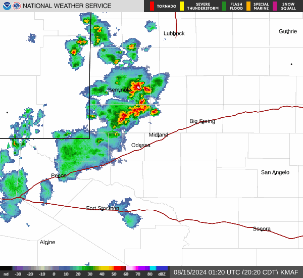
Tonight... Scattered showers and thunderstorms, mainly before 1am. Some of the storms could be severe. Mostly clear, with a low around 58. South wind 15 to 25 mph becoming west after midnight. Winds could gust as high as 35 mph. Chance of precipitation is 40%.

Sunny on Friday Friday... Sunny, with a high near 84. Southwest wind 10 to 15 mph increasing to 15 to 20 mph in the afternoon. Winds could gust as high as 30 mph.

Mostly Clear on Friday Night Friday Night... Mostly clear, with a low around 58. South wind 10 to 20 mph.

20% chance of thunderstorms Saturday Saturday... A slight chance of showers and thunderstorms before 10am, then a slight chance of showers between 10am and 1pm. Mostly sunny, with a high near 84. Southwest wind 15 to 25 mph, with gusts as high as 30 mph. Chance of precipitation is 20%.

20% chance of rain Saturday Night Saturday Night... A 20 percent chance of showers. Partly cloudy, with a low around 54.

Sunny on Sunday Sunday... Sunny, with a high near 82.

Clear on Sunday Night Sunday Night... Clear, with a low around 54.

Sunny on Monday Monday... Sunny, with a high near 87.

Clear on Monday Night Monday Night... Clear, with a low around 60.

Sunny on Tuesday Tuesday... Sunny, with a high near 90.

Cloudy on Tuesday Night Tuesday Night... Partly cloudy, with a low around 65.

20% chance of thunderstorms Wednesday Wednesday... A chance of showers and thunderstorms. Partly sunny, with a high near 85.

20% chance of thunderstorms Wednesday Night Wednesday Night... A chance of showers and thunderstorms. Mostly cloudy, with a low around 60.

20% chance of thunderstorms Thursday Thursday... A chance of showers and thunderstorms. Partly sunny, with a high near 81.

Current Radar Image


Sun Almanac for Luther, Texas
Sunrise: 07:04 AM
Sunset: 8:23 PM
Civil Sunrise:06:39 AM
Civil Sunset: 8:49 PM
Nautical Sunrise: 06:08 AM
Nautical Sunset: 9:20 PM
Astro Sunrise: 05:36 AM
Astro Sunset: 9:52 PM
Any use of the information on this page is at your own risk. This information should not be relied upon in life-threatening situations, potential financial loss situations or in lieu of any officially disseminated information. Visit the National Weather Service for official information.