
| your sport, your way | ||||
 |  |  |  |  |
|

| Today | Tonight | Sunday | Monday | Tuesday | Wednesday | Thursday | Friday |
 |
 |
 |
|
|
 |
 |
 |
| High: 62°F | Low: 43°F | High: 65°F | High: 69°F | High: 74°F | High: 73°F | High: 69°F | High: 76°F |
| Low: 40°F | Low: 47°F | Low: 51°F | Low: 52°F | Low: 57°F | |||
| Thunderstorms | Rain | Sunny | Sunny | Sunny | Thunderstorms | Thunderstorms | Thunderstorms |


|
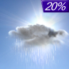
Today... A chance of showers and thunderstorms, mainly before 1pm, then a slight chance of thunderstorms after 5pm. Mostly cloudy, with a high near 62. East northeast wind around 10 mph, with gusts as high as 15 mph. Chance of precipitation is 30%. |
|
Tonight... A slight chance of showers between 7pm and 10pm. Cloudy, then gradually becoming partly cloudy, with a low around 43. East wind 5 to 10 mph becoming north in the evening. Winds could gust as high as 15 mph. Chance of precipitation is 20%. |
|
Sunday... Sunny, with a high near 65. North northeast wind around 10 mph, with gusts as high as 15 mph. |
 |
Sunday Night... Mostly clear, with a low around 40. North wind 5 to 10 mph becoming light after midnight. |
|
Monday... Sunny, with a high near 69. Light and variable wind becoming south 5 to 10 mph in the morning. |
 |
Monday Night... Clear, with a low around 47. South wind 5 to 10 mph. |
|
Tuesday... Sunny, with a high near 74. South southwest wind 5 to 15 mph, with gusts as high as 25 mph. |
 |
Tuesday Night... Partly cloudy, with a low around 51. Southwest wind 5 to 15 mph becoming north after midnight. |
|
Wednesday... A slight chance of showers, with thunderstorms also possible after 1pm. Mostly sunny, with a high near 73. North northeast wind 5 to 10 mph becoming southeast in the afternoon. Chance of precipitation is 20%. |
 |
Wednesday Night... A 30 percent chance of showers and thunderstorms, mainly after 1am. Mostly cloudy, with a low around 52. |
|
Thursday... A 20 percent chance of showers and thunderstorms. Partly sunny, with a high near 69. |
|
Thursday Night... A 30 percent chance of showers and thunderstorms. Mostly cloudy, with a low around 57. |
|
Friday... A 40 percent chance of showers and thunderstorms. Mostly cloudy, with a high near 76. |


