King Acres, Illinois Weather
Issued: 8:56 pm CDT Apr 18, 2024 Latitude: 41.6308333 Longitude: -87.9891667 View on Google Maps
|
|
|
|
|
|
|
|
|
|
 |
 |
 |
|
|
 |
|
 |
| Low: °F |
High: °F |
High: °F |
High: °F |
High: °F |
High: °F |
High: °F |
High: °F |
| Low: °F |
Low: °F |
Low: °F |
Low: °F |
Low: °F |
Low: °F |
|
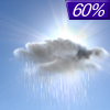
| Rain |
Sunny |
Increasing Clouds |
Sunny |
Sunny |
Partly Sunny |
Sunny |
Mostly Sunny |
Current Conditions at
ROMEOVILLE WFO - (KLOT)
Cloudy
as of 10:15 PM CDST
Rel. Humidity: 100%
Dew Point: 50°F
Visibility: 10 Miles
Pressure: 30.00 in.
Flight Rule: VFR
Wind Data
13 MPH
350° North
Cloud Level(s): Solid Overcast at 3800ft
Current Conditions at
JOLIET - (KJOT)
52°
Cloudy
as of 10:15 PM CDST
Rel. Humidity: 87%
Dew Point: 48°F
Visibility: 10 Miles
Pressure: 29.99 in.
Flight Rule: VFR
Cloud Level(s): Scattered at 3700ft, Solid Overcast at 7000ft
Current Conditions at
CHICAGO-MIDWAY - (KMDW)
50°
Cloudy
as of 9:53 PM CDST
Rel. Humidity: 81%
Dew Point: 45°F
Visibility: 10 Miles
Pressure: 29.98 in.
Flight Rule: VFR
Cloud Level(s): Solid Overcast at 4300ft
Current Conditions at
WEST CHICAGO - (KDPA)
Cloudy
as of 10:18 PM CDST
Rel. Humidity: 93%
Dew Point: 46°F
Visibility: 8 Miles
Pressure: 29.99 in.
Flight Rule: IFR
Wind Data
13 MPH
350° North
Cloud Level(s): Broken at 900ft, Solid Overcast at 5500ft
|
Tonight... Showers likely, mainly before midnight. Cloudy, then gradually becoming partly cloudy, with a low around 41. North northwest wind 10 to 15 mph, with gusts as high as 25 mph. Chance of precipitation is 60%. New precipitation amounts between a tenth and quarter of an inch possible. |
|
|
Friday... Sunny, with a high near 56. Breezy, with a west wind 10 to 20 mph, with gusts as high as 30 mph. |
|
 |
Friday Night... Partly cloudy, with a low around 36. West northwest wind 10 to 15 mph, with gusts as high as 20 mph. |
|
|
Saturday... Increasing clouds, with a high near 51. West northwest wind 10 to 15 mph, with gusts as high as 20 mph. |
|
|
Saturday Night... Areas of frost after 1am. Otherwise, partly cloudy, with a low around 35. West northwest wind 5 to 15 mph. |
|
|
Sunday... Areas of frost before 9am. Otherwise, sunny, with a high near 58. |
|
 |
Sunday Night... Areas of frost after 1am. Otherwise, clear, with a low around 38. |
|
|
Monday... Sunny, with a high near 64. |
|
 |
Monday Night... Showers likely, mainly after 1am. Cloudy, with a low around 51. |
|
|
Tuesday... Showers likely, mainly before 1pm. Partly sunny, with a high near 64. |
|
|
Tuesday Night... Partly cloudy, with a low around 39. |
|
|
Wednesday... Sunny, with a high near 55. |
|
 |
Wednesday Night... Mostly clear, with a low around 38. |
|
|
Thursday... Mostly sunny, with a high near 59. |
|
Current Radar Image
Sun Almanac for King Acres, Illinois
Sunrise: 06:06 AM
Sunset: 7:36 PM
Civil Sunrise:05:37 AM
Civil Sunset: 8:05 PM
Nautical Sunrise: 05:02 AM
Nautical Sunset: 8:41 PM
Astro Sunrise: 04:24 AM
Astro Sunset: 9:18 PM
Illinois' Current Temperatures
 Illinois' Satellite Image
 Illinois' Current Wind Direction
| National Summary |
of upper and lower values of current conditions amongst 6437 locations
in the contiguous United States |
|
High
Temp |
88° |
Phoenix, Arizona
and 2 other locations
|
|
Low
Temp |
7° |
Perryton, Texas
|
|
Wind
Speed |
25mph |
Santa Fe, New Mexico
|
|
Wind
Gust |
45mph |
Owensboro, Kentucky
|
|
Wind
Chill |
7° |
Crosby Municipal, North Dakota
and 1 other location
|
|
Heat
Index |
92° |
Del Rio, Texas
|
|
High
Pressure |
30.36Hg |
Havre, Montana
and 1 other location
|
|
Low
Pressure |
29.75Hg |
Bullhead City, Arizona
|
|
| # Locations Reporting Snow |
15 |
|
| # Locations Reporting Rain |
58 |
|
| # Locations Reporting Thunderstorms / Lightning |
8 |
|
| # Locations Reporting Fog |
1 |
|
| Average Temperature in the Contiguous USA |
56° |
|
Any use of the information on this page is at your own risk. This information should not be relied upon in life-threatening situations, potential financial loss situations or in lieu of any officially disseminated information. Visit the
National Weather Service for official information.


