Hulver, Texas Weather
your sport, your way
Air Sports Net on FacebookAir Sports Net on Google +Air Sports Net on TwitterReceive RSS UpdatesReceive Email Updates

Change location by the zip code or city,state: or search for other weather forecast locations in Texas by name.
Weather Forecast for Hulver, Texas : Hall County
Issued: 11:30 am CDT Apr 24, 2024 Latitude: 34.5272807 Longitude: -100.5156785 View on Google Maps

MouseOver for Detail Forecast
Today Tonight Thursday Friday Saturday Sunday Monday Tuesday
20% chance of thunderstorms on Today 20% chance of thunderstorms on Tonight 30% chance of thunderstorms on Thursday Sunny on Friday 20% chance of rain on Saturday Sunny on Sunday Sunny on Monday Sunny on Tuesday
High: 74°F Low: 60°F High: 83°F High: 87°F High: 88°F High: 82°F High: 82°F High: 88°F
Low: 56°F Low: 56°F Low: 54°F Low: 50°F Low: 54°F  
Thunderstorms Thunderstorms Thunderstorms Sunny Rain Sunny Sunny Sunny
-
Current Conditions at
CHILDRESS - (KCDS)
64°
Cloudy
as of 10:53 AM CDST
Rel. Humidity: 88%
Dew Point: 61°F
Visibility: 9 Miles
Pressure: 30.11 in.
Flight Rule: IFR
Wind Data
7 MPH
080° East
Cloud Level(s): Solid Overcast at 700ft
Current Conditions at
ALTUS - (KAXS)
72°
Mostly Clear
as of 11:15 AM CDST
Rel. Humidity: 68%
Dew Point: 61°F
Visibility: 10 Miles
Pressure: 30.10 in.
Flight Rule: VFR
Wind Data
20 MPH
080° East
Cloud Level(s): Few at 2200ft
Current Conditions at
ALTUS AFB - (KLTS)
72°
Mostly Cloudy
as of 11:10 AM CDST
Rel. Humidity: 73%
Dew Point: 63°F
Visibility: 10 Miles
Pressure: 30.08 in.
Flight Rule: MVFR
Wind Data
15 MPH
080° East
Cloud Level(s): Broken at 1700ft
Current Conditions at
PLAINVIEW - (KPVW)
61°
Cloudy
as of 11:10 AM CDST
Rel. Humidity: 82%
Dew Point: 55°F
Visibility: 10 Miles
Pressure: 30.12 in.
Flight Rule: IFR
Wind Data
13 MPH
100° East
Cloud Level(s): Solid Overcast at 800ft
20% chance of thunderstorms Today 
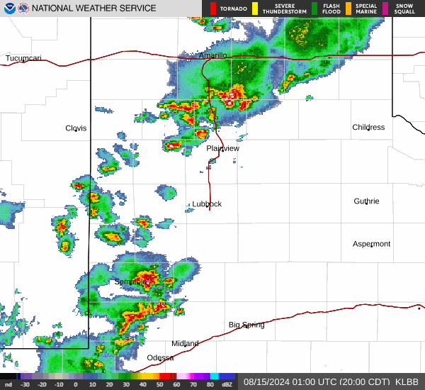
Today... A 20 percent chance of showers and thunderstorms after 4pm. Patchy fog before 1pm. Otherwise, mostly cloudy, with a high near 74. East southeast wind around 10 mph.

20% chance of thunderstorms Tonight Tonight... A 20 percent chance of showers and thunderstorms before 1am. Mostly cloudy, with a low around 60. East southeast wind 5 to 10 mph.

30% chance of thunderstorms Thursday Thursday... A 30 percent chance of showers and thunderstorms after 1pm. Mostly cloudy, with a high near 83. South wind 5 to 10 mph increasing to 15 to 20 mph in the afternoon.

40% chance of thunderstorms Thursday Night Thursday Night... A chance of showers and thunderstorms. Mostly clear, with a low around 56. Breezy, with a south wind 20 to 25 mph decreasing to 15 to 20 mph after midnight. Winds could gust as high as 40 mph. Chance of precipitation is 40%.

Sunny on Friday Friday... Sunny, with a high near 87. Breezy, with a west southwest wind 15 to 25 mph, with gusts as high as 35 mph.

Mostly Clear on Friday Night Friday Night... Mostly clear, with a low around 56. Southwest wind 15 to 20 mph, with gusts as high as 30 mph.

20% chance of rain Saturday Saturday... A 20 percent chance of showers. Sunny, with a high near 88. Breezy, with a south southwest wind 15 to 20 mph increasing to 20 to 25 mph in the afternoon. Winds could gust as high as 40 mph.

10% chance of thunderstorms Saturday Night Saturday Night... A slight chance of showers and thunderstorms before 1am. Partly cloudy, with a low around 54. Breezy, with a southwest wind 15 to 25 mph, with gusts as high as 40 mph.

Sunny on Sunday Sunday... Sunny, with a high near 82. West wind around 15 mph.

Mostly Clear on Sunday Night Sunday Night... Mostly clear, with a low around 50.

Sunny on Monday Monday... Sunny, with a high near 82.

Mostly Clear on Monday Night Monday Night... Mostly clear, with a low around 54.

Sunny on Tuesday Tuesday... Sunny, with a high near 88.

Current Radar Image


Sun Almanac for Hulver, Texas
Sunrise: 06:59 AM
Sunset: 8:21 PM
Civil Sunrise:06:32 AM
Civil Sunset: 8:48 PM
Nautical Sunrise: 06:01 AM
Nautical Sunset: 9:20 PM
Astro Sunrise: 05:27 AM
Astro Sunset: 9:53 PM
Any use of the information on this page is at your own risk. This information should not be relied upon in life-threatening situations, potential financial loss situations or in lieu of any officially disseminated information. Visit the National Weather Service for official information.