Durham, Wyoming Weather
your sport, your way
Air Sports Net on FacebookAir Sports Net on Google +Air Sports Net on TwitterReceive RSS UpdatesReceive Email Updates

Change location by the zip code or city,state: or search for other weather forecast locations in Wyoming by name.
Weather Forecast for Durham, Wyoming : Laramie County
Issued: 8:46 pm MDT Apr 19, 2024 Latitude: 41.2055362 Longitude: -104.5957971 View on Google Maps

MouseOver for Detail Forecast
Tonight Saturday Sunday Monday Tuesday Wednesday Thursday Friday
50% chance of freezing drizzle on Tonight 50% chance of freezing drizzle on Saturday Sunny on Sunday 20% chance of rain on Monday Mostly Sunny on Tuesday 20% chance of thunderstorms on Wednesday 20% chance of thunderstorms on Thursday Thunderstorms on Friday
Low: 23°F High: 37°F High: 59°F High: 65°F High: 57°F High: 71°F High: 70°F High: 59°F
Low: 24°F Low: 38°F Low: 33°F Low: 38°F Low: 44°F Low: 43°F  
Freezing Drizzle Freezing Drizzle Sunny Rain Mostly Sunny Thunderstorms Thunderstorms Thunderstorms
-
Current Conditions at
CHEYENNE - (KCYS)
30°
Cloudy
as of 9:53 PM MDST
Rel. Humidity: 68%
Dew Point: 21°F
Visibility: 10 Miles
Pressure: 30.30 in.
Flight Rule: VFR
Wind Data
3 MPH
150° Southeast
Cloud Level(s): Solid Overcast at 3400ft
Current Conditions at
KIMBALL - (KIBM)
34°
Cloudy
as of 9:55 PM MDST
Rel. Humidity: 74%
Dew Point: 27°F
Visibility: 10 Miles
Pressure: 30.32 in.
Flight Rule: VFR
Wind Data
Calm
Cloud Level(s): Solid Overcast at 6000ft
Current Conditions at
GREELEY - (KGXY)
34°
Cloudy
as of 9:56 PM MDST
Rel. Humidity: 86%
Dew Point: 30°F
Visibility: 10 Miles
Pressure: 30.36 in.
Flight Rule: VFR
Wind Data
5 MPH
100° East
Cloud Level(s): Few at 1100ft, Solid Overcast at 3700ft
Current Conditions at
FT COLLINS - (KFNL)
34°
Cloudy
as of 9:56 PM MDST
Rel. Humidity: 86%
Dew Point: 30°F
Visibility: 10 Miles
Pressure: 30.35 in.
Flight Rule: VFR
Wind Data
7 MPH
140° Southeast
Cloud Level(s): Solid Overcast at 3700ft
50% chance of freezing drizzle Tonight 
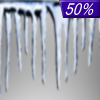
Tonight... A chance of snow before 4am, then freezing drizzle likely, possibly mixed with snow. Widespread fog, mainly after 3am. Otherwise, cloudy, with a low around 23. East southeast wind 5 to 10 mph. Chance of precipitation is 50%.

50% chance of freezing drizzle Saturday Saturday... Snow and freezing drizzle likely before 11am, then a chance of freezing drizzle between 11am and noon. Widespread fog, mainly before 9am. Otherwise, cloudy, with a high near 37. East southeast wind around 10 mph. Chance of precipitation is 50%.

Fog on Saturday Night Saturday Night... Areas of fog after midnight. Otherwise, mostly cloudy, with a low around 24. Southeast wind 5 to 10 mph becoming southwest after midnight.

Sunny on Sunday Sunday... Sunny, with a high near 59. Southwest wind 10 to 15 mph.

Cloudy on Sunday Night Sunday Night... Partly cloudy, with a low around 38. South southwest wind 10 to 15 mph becoming west northwest after midnight.

20% chance of rain Monday Monday... A 20 percent chance of showers after noon. Mostly sunny, with a high near 65. Breezy.

Cloudy on Monday Night Monday Night... Partly cloudy, with a low around 33. Breezy.

Mostly Sunny on Tuesday Tuesday... Mostly sunny, with a high near 57.

10% chance of rain Tuesday Night Tuesday Night... A slight chance of showers before midnight. Mostly cloudy, with a low around 38.

20% chance of thunderstorms Wednesday Wednesday... A chance of showers and thunderstorms after noon. Mostly sunny, with a high near 71.

10% chance of rain Wednesday Night Wednesday Night... A slight chance of showers. Partly cloudy, with a low around 44.

20% chance of thunderstorms Thursday Thursday... A chance of showers and thunderstorms. Partly sunny, with a high near 70.

20% chance of rain Thursday Night Thursday Night... A chance of showers. Mostly cloudy, with a low around 43.

Thunderstorms on Friday Friday... Showers likely and possibly a thunderstorm. Partly sunny, with a high near 59.

Current Radar Image


Sun Almanac for Durham, Wyoming
Sunrise: 06:10 AM
Sunset: 7:44 PM
Civil Sunrise:05:41 AM
Civil Sunset: 8:13 PM
Nautical Sunrise: 05:06 AM
Nautical Sunset: 8:48 PM
Astro Sunrise: 04:29 AM
Astro Sunset: 9:26 PM
Any use of the information on this page is at your own risk. This information should not be relied upon in life-threatening situations, potential financial loss situations or in lieu of any officially disseminated information. Visit the National Weather Service for official information.