No Watches or Warnings for Democrat
Issued: 2:21 pm CDT Apr 19, 2024 Latitude: 31.6873765 Longitude: -98.6586564 View on Google Maps
|
|
|
|
|
|
|
|
|
|
 |
 |
 |
 |
 |
 |
 |
|
| High: °F |
Low: °F |
High: °F |
High: °F |
High: °F |
High: °F |
High: °F |
High: °F |
| Low: °F |
Low: °F |
Low: °F |
Low: °F |
Low: °F |
|
| Mostly Cloudy |
Thunderstorms |
Thunderstorms |
Morning Fog |
Mostly Sunny |
Sunny |
Partly Sunny |
Partly Sunny |
Current Conditions at
COMANCHE - (KMKN)
66°
Cloudy
as of 2:15 PM CDST
Rel. Humidity: 63%
Dew Point: 54°F
Visibility: 10 Miles
Pressure: 30.12 in.
Flight Rule: MVFR
Cloud Level(s): Solid Overcast at 2500ft
Current Conditions at
BROWNWOOD - (KBWD)
64°
Cloudy
as of 2:15 PM CDST
Rel. Humidity: 59%
Dew Point: 50°F
Visibility: 8 Miles
Pressure: 30.12 in.
Flight Rule: MVFR
Cloud Level(s): Solid Overcast at 2500ft
Current Conditions at
STEPHENVILLE - (KSEP)
66°
Cloudy
as of 2:15 PM CDST
Rel. Humidity: 59%
Dew Point: 52°F
Visibility: 10 Miles
Pressure: 30.13 in.
Flight Rule: MVFR
Cloud Level(s): Solid Overcast at 2400ft
Current Conditions at
CURTIS FIELD - (KBBD)
63°
Cloudy
as of 2:15 PM CDST
Rel. Humidity: 63%
Dew Point: 50°F
Visibility: 10 Miles
Pressure: 30.10 in.
Flight Rule: MVFR
Wind Data
12 MPH
040° Northeast
Cloud Level(s): Solid Overcast at 2000ft
|
This Afternoon... Mostly cloudy, with a high near 65. Northeast wind around 10 mph. |
|
|
Tonight... Showers likely and possibly a thunderstorm after 1am. Mostly cloudy, with a low around 57. East northeast wind around 10 mph. Chance of precipitation is 70%. New rainfall amounts of less than a tenth of an inch, except higher amounts possible in thunderstorms. |
|
|
Saturday... Showers and possibly a thunderstorm. Patchy fog after 8am. High near 59. Northeast wind 10 to 15 mph, with gusts as high as 25 mph. Chance of precipitation is 90%. New rainfall amounts between a half and three quarters of an inch possible. |
|
 |
Saturday Night... Showers and possibly a thunderstorm before 1am, then a chance of showers and thunderstorms after 1am. Patchy fog. Low around 45. North northeast wind around 15 mph, with gusts as high as 25 mph. Chance of precipitation is 90%. |
|
|
Sunday... Patchy fog before 11am. Otherwise, mostly cloudy, with a high near 59. North northeast wind around 15 mph, with gusts as high as 25 mph. |
|
 |
Sunday Night... Partly cloudy, with a low around 43. East wind 5 to 10 mph. |
|
|
Monday... Mostly sunny, with a high near 68. South southeast wind 5 to 15 mph, with gusts as high as 20 mph. |
|
 |
Monday Night... Mostly clear, with a low around 52. South wind around 15 mph, with gusts as high as 25 mph. |
|
|
Tuesday... Sunny, with a high near 78. South wind around 15 mph, with gusts as high as 25 mph. |
|
|
Tuesday Night... Partly cloudy, with a low around 59. |
|
|
Wednesday... Partly sunny, with a high near 77. |
|
 |
Wednesday Night... Mostly cloudy, with a low around 64. |
|
|
Thursday... Partly sunny, with a high near 80. |
|
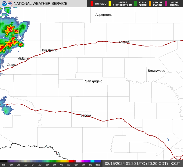
Current Radar Image
Sun Almanac for Democrat, Texas
Sunrise: 07:01 AM
Sunset: 8:07 PM
Civil Sunrise:06:35 AM
Civil Sunset: 8:32 PM
Nautical Sunrise: 06:05 AM
Nautical Sunset: 9:02 PM
Astro Sunrise: 05:34 AM
Astro Sunset: 9:33 PM
Texas' Current Temperatures
 Texas' Satellite Image
 Texas' Current Wind Direction
| National Summary |
of upper and lower values of current conditions amongst 6583 locations
in the contiguous United States |
|
High
Temp |
91° |
Jacksonville Cecil Fld, Florida
and 3 other locations
|
|
Low
Temp |
18° |
Perryton, Texas
|
|
Wind
Speed |
38mph |
Salida Mountain, Colorado
|
|
Wind
Gust |
47mph |
Faith, South Dakota
and 4 other locations
|
|
Wind
Chill |
11° |
Berthoud Pass, Colorado
|
|
Heat
Index |
101° |
Falfurrias, Texas
|
|
High
Pressure |
30.47Hg |
Havre, Montana
|
|
Low
Pressure |
29.78Hg |
Ogdensburg Intl, New York
and 1 other location
|
|
| # Locations Reporting Snow |
20 |
|
| # Locations Reporting Rain |
37 |
|
| # Locations Reporting Thunderstorms / Lightning |
1 |
|
| # Locations Reporting Fog |
1 |
|
| Average Temperature in the Contiguous USA |
61° |
|
Any use of the information on this page is at your own risk. This information should not be relied upon in life-threatening situations, potential financial loss situations or in lieu of any officially disseminated information. Visit the
National Weather Service for official information.