Dalkena, Washington Weather
No Watches or Warnings for Dalkena
Issued: 6:08 am PDT Apr 20, 2024 Latitude: 48.2449036 Longitude: -117.2377146 View on Google Maps
|
|
|
|
|
|
|
|
|
|
 |
 |
 |
|
 |
 |
|
 |
| High: °F |
Low: °F |
High: °F |
High: °F |
High: °F |
High: °F |
High: °F |
High: °F |
| Low: °F |
Low: °F |
Low: °F |
Low: °F |
Low: °F |
|
| Sunny |
Rain |
Snow |
Sunny |
Mostly Sunny |
Partly Sunny |
Snow |
Rain |
Current Conditions at
DEER PARK - (KDEW)
Clear
as of 5:53 AM PDST
Rel. Humidity: 40%
Dew Point: 16°F
Visibility: 10 Miles
Pressure: 30.19 in.
Flight Rule: VFR
Wind Data
15 MPH
040° Northeast
Cloud Level(s): Clear
Current Conditions at
SANDPOINT - (KSZT)
Clear
as of 6:35 AM PDST
Rel. Humidity: 37%
Dew Point: 14°F
Visibility: 10 Miles
Pressure: 30.25 in.
Flight Rule: VFR
Wind Data
14 MPH
Gust: 21 MPH
040° Northeast
Cloud Level(s): Clear
Current Conditions at
COEUR D'ALENE - (KCOE)
Clear
as of 5:56 AM PDST
Rel. Humidity: 43%
Dew Point: 16°F
Visibility: 10 Miles
Pressure: 30.20 in.
Flight Rule: VFR
Wind Data
16 MPH
020° North
Cloud Level(s): Clear
|
Today... Sunny, with a high near 64. North wind 6 to 9 mph becoming east in the afternoon. Winds could gust as high as 18 mph. |
|
|
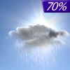
Tonight... Showers likely, mainly after 11pm. Cloudy, then gradually becoming partly cloudy, with a low around 36. East wind 6 to 13 mph becoming southwest after midnight. Chance of precipitation is 70%. New precipitation amounts between a tenth and quarter of an inch possible. |
|
|
Sunday... A 20 percent chance of showers. Snow level 2800 feet rising to 3800 feet in the afternoon. Mostly sunny, with a high near 58. Southwest wind 10 to 16 mph, with gusts as high as 25 mph. |
|
 |
Sunday Night... Widespread frost, mainly after 3am. Otherwise, mostly clear, with a low around 31. Southwest wind 5 to 14 mph. |
|
|
Monday... Widespread frost, mainly before 7am. Otherwise, sunny, with a high near 62. Calm wind becoming southwest around 6 mph in the afternoon. |
|
|
Monday Night... Widespread frost, mainly after 4am. Otherwise, mostly clear, with a low around 34. |
|
|
Tuesday... Mostly sunny, with a high near 68. |
|
 |
Tuesday Night... Mostly cloudy, with a low around 40. |
|
|
Wednesday... A 30 percent chance of showers, mainly after 11am. Partly sunny, with a high near 65. |
|
 |
Wednesday Night... A 20 percent chance of showers before 11pm. Mostly cloudy, with a low around 37. |
|
|
Thursday... A 20 percent chance of showers. Snow level 4300 feet rising to 5100 feet in the afternoon. Partly sunny, with a high near 63. |
|
|
Thursday Night... A 20 percent chance of showers. Mostly cloudy, with a low around 39. |
|
|
Friday... A 40 percent chance of showers. Mostly cloudy, with a high near 63. |
|
Current Radar Image
Sun Almanac for Dalkena, Washington
Sunrise: 05:48 AM
Sunset: 7:48 PM
Civil Sunrise:05:14 AM
Civil Sunset: 8:21 PM
Nautical Sunrise: 04:33 AM
Nautical Sunset: 9:03 PM
Astro Sunrise: 03:47 AM
Astro Sunset: 9:49 PM
Washington's Current Temperatures
 Washington's Satellite Image
 Washington's Current Wind Direction
| National Summary |
of upper and lower values of current conditions amongst 7200 locations
in the contiguous United States |
|
High
Temp |
81° |
Fort Lauderdale Intl, Florida
and 4 other locations
|
|
Low
Temp |
-15° |
Front Royal, Virginia
|
|
Wind
Speed |
29mph |
Iowa Falls Municipal A/P, Iowa
|
|
Wind
Gust |
37mph |
Iowa Falls Municipal A/P, Iowa
|
|
Wind
Chill |
-16° |
Perryton, Texas
|
|
High
Pressure |
30.46Hg |
Hebron, Nebraska
and 3 other locations
|
|
Low
Pressure |
29.77Hg |
Frenchville, Maine
|
|
| # Locations Reporting Snow |
34 |
|
| # Locations Reporting Rain |
114 |
|
| # Locations Reporting Thunderstorms / Lightning |
13 |
|
| # Locations Reporting Fog |
11 |
|
| Average Temperature in the Contiguous USA |
49° |
|
Any use of the information on this page is at your own risk. This information should not be relied upon in life-threatening situations, potential financial loss situations or in lieu of any officially disseminated information. Visit the
National Weather Service for official information.


