Carsley, Virginia Weather
No Watches or Warnings for Carsley
Issued: 3:28 am EDT Apr 20, 2024 Latitude: 37.0957057 Longitude: -77.0057967 View on Google Maps
|
|
|
|
|
|
|
|
|
|
 |
 |
 |
 |
|
 |
|
|
| Low: °F |
High: °F |
High: °F |
High: °F |
High: °F |
High: °F |
High: °F |
High: °F |
| Low: °F |
Low: °F |
Low: °F |
Low: °F |
Low: °F |
Low: °F |
|
| Thunderstorms |
Thunderstorms |
Rain |
Sunny |
Sunny |
Mostly Sunny |
Sunny |
Mostly Sunny |
Current Conditions at
WAKEFIELD - (KAKQ)
54°
Cloudy
Mist
as of 3:54 AM EDST
Rel. Humidity: 93%
Dew Point: 52°F
Visibility: 1 1/2 Miles
Pressure: 29.99 in.
Flight Rule: LIFR
Cloud Level(s): Solid Overcast at 300ft
Current Conditions at
FORT EUSTIS - (KFAF)
55°
Cloudy
Mist
as of 4:10 AM EDST
Rel. Humidity: 93%
Dew Point: 54°F
Visibility: 2 1/2 Miles
Pressure: 29.96 in.
Flight Rule: LIFR
Cloud Level(s): Solid Overcast at 300ft
Current Conditions at
FRANKLIN/J B ROSE - (KFKN)
54°
Cloudy
Mist
as of 4:15 AM EDST
Rel. Humidity: 93%
Dew Point: 52°F
Visibility: 2 Miles
Pressure: 29.99 in.
Flight Rule: LIFR
Cloud Level(s): Solid Overcast at 300ft
|
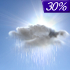
Overnight... A chance of showers and thunderstorms, mainly after 5am. Cloudy, with a low around 54. Calm wind. Chance of precipitation is 30%. New rainfall amounts of less than a tenth of an inch, except higher amounts possible in thunderstorms. |
|
|
Saturday... A chance of showers and thunderstorms before 8am, then a chance of showers between 8am and 11am. Cloudy, then gradually becoming mostly sunny, with a high near 70. Calm wind becoming north around 6 mph in the morning. Chance of precipitation is 40%. New precipitation amounts of less than a tenth of an inch, except higher amounts possible in thunderstorms. |
|
 |
Saturday Night... Partly cloudy, with a low around 46. Light and variable wind. |
|
|
Sunday... A chance of rain, mainly after 2pm. Mostly cloudy, with a high near 59. North wind 3 to 6 mph. Chance of precipitation is 40%. New precipitation amounts of less than a tenth of an inch possible. |
|
 |
Sunday Night... A chance of rain, mainly before 8pm. Cloudy, then gradually becoming partly cloudy, with a low around 40. Light and variable wind. Chance of precipitation is 30%. New precipitation amounts of less than a tenth of an inch possible. |
|
|
Monday... Sunny, with a high near 66. |
|
 |
Monday Night... Mostly clear, with a low around 39. |
|
|
Tuesday... Sunny, with a high near 71. |
|
|
Tuesday Night... Partly cloudy, with a low around 49. |
|
|
Wednesday... Mostly sunny, with a high near 73. |
|
|
Wednesday Night... Mostly clear, with a low around 42. |
|
|
Thursday... Sunny, with a high near 67. |
|
|
Thursday Night... Mostly clear, with a low around 42. |
|
|
Friday... Mostly sunny, with a high near 70. |
|
Current Radar Image
Sun Almanac for Carsley, Virginia
Sunrise: 06:26 AM
Sunset: 7:48 PM
Civil Sunrise:05:59 AM
Civil Sunset: 8:15 PM
Nautical Sunrise: 05:26 AM
Nautical Sunset: 8:47 PM
Astro Sunrise: 04:52 AM
Astro Sunset: 9:22 PM
Virginia's Current Temperatures
 Virginia's Satellite Image
 Virginia's Current Wind Direction
| National Summary |
of upper and lower values of current conditions amongst 7009 locations
in the contiguous United States |
|
High
Temp |
82° |
Phoenix, Arizona
|
|
Low
Temp |
-35° |
Front Royal, Virginia
|
|
Wind
Speed |
32mph |
Albuquerque, New Mexico
|
|
Wind
Gust |
51mph |
Albuquerque, New Mexico
|
|
Wind
Chill |
7° |
Crosby Municipal, North Dakota
and 1 other location
|
|
High
Pressure |
30.46Hg |
Malta, Montana
and 1 other location
|
|
Low
Pressure |
29.77Hg |
Frenchville, Maine
and 2 other locations
|
|
| # Locations Reporting Snow |
36 |
|
| # Locations Reporting Rain |
48 |
|
| # Locations Reporting Thunderstorms / Lightning |
10 |
|
| # Locations Reporting Fog |
19 |
|
| Average Temperature in the Contiguous USA |
50° |
|
Any use of the information on this page is at your own risk. This information should not be relied upon in life-threatening situations, potential financial loss situations or in lieu of any officially disseminated information. Visit the
National Weather Service for official information.


