No Watches or Warnings for Burbank
Issued: 3:45 pm EDT Apr 19, 2024 Latitude: 29.2908084 Longitude: -82.0009213 View on Google Maps
|
|
|
|
|
|
|
|
|
|
 |
 |
 |
 |
 |
|
|
|
| Low: °F |
High: °F |
High: °F |
High: °F |
High: °F |
High: °F |
High: °F |
High: °F |
| Low: °F |
Low: °F |
Low: °F |
Low: °F |
Low: °F |
Low: °F |
|
| Morning Fog |
Morning Fog |
Partly Sunny |
Thunderstorms |
Sunny |
Sunny |
Sunny |
Sunny |
Current Conditions at
OCALA MUNICIPAL - (KOCF)
88°
Clear
as of 4:51 PM EDST
Rel. Humidity: 43%
Dew Point: 63°F
Visibility: 10 Miles
Pressure: 30.01 in.
Flight Rule: VFR
Wind Data
12 MPH
230° Southwest
Cloud Level(s): Clear
Current Conditions at
GAINESVILLE - (KGNV)
88°
Clear
as of 4:53 PM EDST
Rel. Humidity: 40%
Dew Point: 61°F
Visibility: 10 Miles
Pressure: 30.01 in.
Flight Rule: VFR
Wind Data
8 MPH
Gust: 16 MPH
300° Northwest
Cloud Level(s): Clear
Current Conditions at
DAYTONA BEACH - (KDAB)
82°
Mostly Clear
as of 4:53 PM EDST
Rel. Humidity: 65%
Dew Point: 70°F
Visibility: 10 Miles
Pressure: 30.00 in.
Flight Rule: VFR
Cloud Level(s): Few at 5000ft
|
Tonight... Patchy fog after 5am. Otherwise, mostly clear, with a low around 61. West wind 5 to 8 mph becoming calm after midnight. |
|
|
Saturday... Patchy fog before 10am. Otherwise, partly sunny, then gradually becoming sunny, with a high near 91. Calm wind becoming west 5 to 8 mph in the afternoon. |
|
 |
Saturday Night... Increasing clouds, with a low around 62. West wind 5 to 10 mph, with gusts as high as 16 mph. |
|
|
Sunday... Partly sunny, with a high near 86. Breezy, with a southwest wind 5 to 15 mph, with gusts as high as 23 mph. |
|
 |
Sunday Night... A 40 percent chance of showers and thunderstorms. Mostly cloudy, with a low around 64. West wind 6 to 10 mph, with gusts as high as 16 mph. |
|
|
Monday... A chance of showers, with thunderstorms also possible after 11am. Mostly cloudy, with a high near 78. Chance of precipitation is 50%. |
|
 |
Monday Night... A slight chance of thunderstorms before 8pm. Mostly cloudy, with a low around 55. Chance of precipitation is 10%. |
|
|
Tuesday... Sunny, with a high near 81. |
|
 |
Tuesday Night... Mostly clear, with a low around 56. |
|
|
Wednesday... Sunny, with a high near 84. |
|
|
Wednesday Night... Mostly clear, with a low around 58. |
|
|
Thursday... Sunny, with a high near 86. |
|
|
Thursday Night... Mostly clear, with a low around 60. |
|
|
Friday... Sunny, with a high near 86. |
|
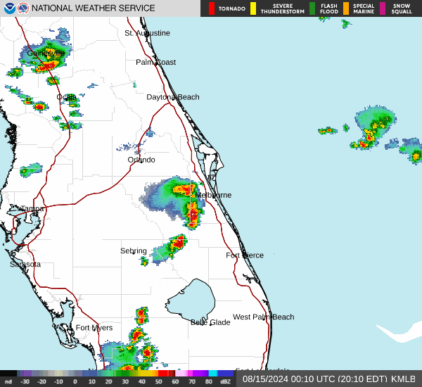
Current Radar Image
Sun Almanac for Burbank, Florida
Sunrise: 06:57 AM
Sunset: 7:57 PM
Civil Sunrise:06:32 AM
Civil Sunset: 8:22 PM
Nautical Sunrise: 06:03 AM
Nautical Sunset: 8:51 PM
Astro Sunrise: 05:33 AM
Astro Sunset: 9:21 PM
Florida's Current Temperatures
 Florida's Satellite Image
 Florida's Current Wind Direction
| National Summary |
of upper and lower values of current conditions amongst 7052 locations
in the contiguous United States |
|
High
Temp |
93° |
Tucson/Marana, Arizona
and 5 other locations
|
|
Low
Temp |
19° |
Perryton, Texas
|
|
Wind
Speed |
40mph |
Salida Mountain, Colorado
|
|
Wind
Gust |
48mph |
Hancock, Michigan
|
|
Wind
Chill |
15° |
Rolla Municipal A/P, North Dakota
and 1 other location
|
|
Heat
Index |
101° |
Falfurrias, Texas
|
|
High
Pressure |
30.48Hg |
Havre, Montana
|
|
Low
Pressure |
29.74Hg |
Thermal, California
|
|
| # Locations Reporting Snow |
20 |
|
| # Locations Reporting Rain |
33 |
|
| # Locations Reporting Thunderstorms / Lightning |
3 |
|
| # Locations Reporting Fog |
1 |
|
| Average Temperature in the Contiguous USA |
62° |
|
Any use of the information on this page is at your own risk. This information should not be relied upon in life-threatening situations, potential financial loss situations or in lieu of any officially disseminated information. Visit the
National Weather Service for official information.