No Watches or Warnings for Averill
Issued: 1:04 pm EDT Apr 19, 2024 Latitude: 44.9981018 Longitude: -71.7103705 View on Google Maps
|
|
|
|
|
|
|
|
|
|
 |
 |
 |
|
 |
|
 |
 |
| High: °F |
Low: °F |
High: °F |
High: °F |
High: °F |
High: °F |
High: °F |
High: °F |
| Low: °F |
Low: °F |
Low: °F |
Low: °F |
Low: °F |
|
| Mostly Cloudy |
Rain |
Partly Sunny |
Mostly Cloudy |
Mostly Sunny |
Partly Sunny |
Rain |
Snow |
Current Conditions at
BERLIN - (KBML)
57°
Cloudy
as of 1:52 PM EDST
Rel. Humidity: 38%
Dew Point: 32°F
Visibility: 10 Miles
Pressure: 30.02 in.
Flight Rule: VFR
Wind Data
17 MPH
Gust: 28 MPH
150° Southeast
Cloud Level(s): Solid Overcast at 6000ft
Current Conditions at
ST JOHNSBURY - (K1V4)
55°
Cloudy
as of 1:54 PM EDST
Rel. Humidity: 47%
Dew Point: 36°F
Pressure: 30.01 in.
Current Conditions at
WHITEFIELD - (KHIE)
55°
Partly Cloudy
as of 1:52 PM EDST
Rel. Humidity: 40%
Dew Point: 32°F
Visibility: 10 Miles
Pressure: 30.02 in.
Flight Rule: VFR
Wind Data
16 MPH
Gust: 23 MPH
160° South
Cloud Level(s): Scattered at 4500ft
Current Conditions at
BURLINGTON - (KBTV)
55°
Mostly Cloudy
as of 1:54 PM EDST
Rel. Humidity: 54%
Dew Point: 39°F
Visibility: 10 Miles
Pressure: 29.96 in.
Flight Rule: VFR
Wind Data
20 MPH
Gust: 29 MPH
200° South
Cloud Level(s): Broken at 3600ft, Broken at 7000ft
|
This Afternoon... Mostly cloudy, with a high near 54. South wind around 14 mph. |
|
|
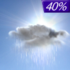
Tonight... A 40 percent chance of showers, mainly after 11pm. Cloudy during the early evening, then becoming partly cloudy, with a low around 38. South wind 10 to 18 mph. New precipitation amounts of less than a tenth of an inch possible. |
|
|
Saturday... A chance of showers before 10am, then a chance of showers after noon. Partly sunny, with a high near 46. West wind 10 to 13 mph. Chance of precipitation is 30%. New precipitation amounts of less than a tenth of an inch possible. |
|
 |
Saturday Night... A chance of rain showers, mixing with snow after 9pm, then gradually ending. Mostly cloudy, with a low around 31. West wind 9 to 11 mph. Chance of precipitation is 30%. Little or no snow accumulation expected. |
|
|
Sunday... Mostly cloudy, with a high near 44. West wind 10 to 14 mph. |
|
|
Sunday Night... A chance of rain and snow showers before 10pm, then a chance of snow showers between 10pm and 2am. Mostly cloudy, with a low around 26. West wind 11 to 16 mph. Chance of precipitation is 30%. New precipitation amounts of less than a tenth of an inch possible. |
|
|
Monday... Mostly sunny, with a high near 37. West wind 15 to 18 mph. |
|
 |
Monday Night... Mostly clear, with a low around 25. West wind 7 to 9 mph becoming south after midnight. |
|
|
Tuesday... Partly sunny, with a high near 53. South wind 9 to 17 mph. |
|
 |
Tuesday Night... Showers likely, mainly after 2am. Mostly cloudy, with a low around 37. South wind 14 to 17 mph. Chance of precipitation is 60%. |
|
|
Wednesday... Showers likely. Mostly cloudy, with a high near 44. South wind around 14 mph. Chance of precipitation is 70%. |
|
 |
Wednesday Night... A chance of rain and snow showers. Mostly cloudy, with a low around 22. West wind around 11 mph. Chance of precipitation is 50%. |
|
|
Thursday... A 30 percent chance of snow showers. Partly sunny, with a high near 37. West wind 13 to 15 mph. |
|
Current Radar Image
Sun Almanac for Averill, Vermont
Sunrise: 05:54 AM
Sunset: 7:38 PM
Civil Sunrise:05:23 AM
Civil Sunset: 8:09 PM
Nautical Sunrise: 04:45 AM
Nautical Sunset: 8:47 PM
Astro Sunrise: 04:04 AM
Astro Sunset: 9:28 PM
Vermont's Current Temperatures
 Vermont's Satellite Image
 Vermont's Current Wind Direction
| National Summary |
of upper and lower values of current conditions amongst 4978 locations
in the contiguous United States |
|
High
Temp |
90° |
Plant City Municipal A/P, Florida
and 3 other locations
|
|
Low
Temp |
14° |
Perryton, Texas
|
|
Wind
Speed |
38mph |
Monroe, Wisconsin
|
|
Wind
Gust |
45mph |
St James, Minnesota
|
|
Wind
Chill |
11° |
Crosby Municipal, North Dakota
|
|
Heat
Index |
100° |
Falfurrias, Texas
|
|
High
Pressure |
30.46Hg |
Malmstrom AFB, Montana
|
|
Low
Pressure |
29.78Hg |
Grand Marais, Minnesota
|
|
| # Locations Reporting Snow |
20 |
|
| # Locations Reporting Rain |
22 |
|
| # Locations Reporting Thunderstorms / Lightning |
10 |
|
| Average Temperature in the Contiguous USA |
58° |
|
Any use of the information on this page is at your own risk. This information should not be relied upon in life-threatening situations, potential financial loss situations or in lieu of any officially disseminated information. Visit the
National Weather Service for official information.


