Allentown, Connecticut Weather
No Watches or Warnings for Allentown
Issued: 1:12 am EDT Apr 20, 2024 Latitude: 41.6489866 Longitude: -72.9903829 View on Google Maps
|
|
|
|
|
|
|
|
|
|
 |
 |
 |
 |
|
 |
|
|
| Low: °F |
High: °F |
High: °F |
High: °F |
High: °F |
High: °F |
High: °F |
High: °F |
| Low: °F |
Low: °F |
Low: °F |
Low: °F |
Low: °F |
Low: °F |
|
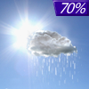
| Rain |
Rain |
Mostly Sunny |
Sunny |
Mostly Sunny |
Rain |
Sunny |
Sunny |
Current Conditions at
MERIDEN - (KMMK)
48°
Cloudy
as of 12:53 AM EDST
Rel. Humidity: 81%
Dew Point: 43°F
Visibility: 10 Miles
Pressure: 30.03 in.
Flight Rule: IFR
Cloud Level(s): Solid Overcast at 800ft
Current Conditions at
OXFORD - (KOXC)
45°
Cloudy
Mist
as of 12:51 AM EDST
Rel. Humidity: 100%
Dew Point: 45°F
Visibility: 1 1/2 Miles
Pressure: 30.02 in.
Flight Rule: LIFR
Cloud Level(s): Solid Overcast at 200ft
Current Conditions at
HARTFORD-BRAINARD - (KHFD)
48°
Cloudy
as of 12:53 AM EDST
Rel. Humidity: 81%
Dew Point: 43°F
Visibility: 10 Miles
Pressure: 30.02 in.
Flight Rule: MVFR
Cloud Level(s): Solid Overcast at 1100ft
Current Conditions at
WESTFIELD - (KBAF)
Cloudy
as of 12:53 AM EDST
Rel. Humidity: 81%
Dew Point: 43°F
Visibility: 10 Miles
Pressure: 30.01 in.
Flight Rule: MVFR
Cloud Level(s): Solid Overcast at 1200ft
|
Overnight... Showers likely, mainly after 4am. Cloudy, with a low around 44. Southwest wind around 8 mph. Chance of precipitation is 60%. New precipitation amounts between a tenth and quarter of an inch possible. |
|
|
Saturday... Showers likely before noon, then a slight chance of showers after 5pm. Cloudy, then gradually becoming mostly sunny, with a high near 59. West wind 5 to 10 mph. Chance of precipitation is 70%. New precipitation amounts between a tenth and quarter of an inch possible. |
|
 |
Saturday Night... Mostly cloudy, then gradually becoming clear, with a low around 35. Northwest wind 11 to 15 mph. |
|
|
Sunday... Mostly sunny, with a high near 55. West wind 10 to 13 mph. |
|
 |
Sunday Night... Mostly clear, with a low around 36. West wind 8 to 10 mph. |
|
|
Monday... Sunny, with a high near 55. |
|
|
Monday Night... Mostly clear, with a low around 33. |
|
|
Tuesday... Mostly sunny, with a high near 58. |
|
|
Tuesday Night... Mostly cloudy, with a low around 43. |
|
|
Wednesday... Showers likely, mainly after 2pm. Mostly cloudy, with a high near 57. Breezy. Chance of precipitation is 60%. |
|
|
Wednesday Night... Showers likely. Partly cloudy, with a low around 33. Chance of precipitation is 60%. |
|
|
Thursday... Sunny, with a high near 53. |
|
|
Thursday Night... Mostly clear, with a low around 34. |
|
|
Friday... Sunny, with a high near 57. |
|
Current Radar Image
Sun Almanac for Allentown, Connecticut
Sunrise: 06:03 AM
Sunset: 7:38 PM
Civil Sunrise:05:34 AM
Civil Sunset: 8:08 PM
Nautical Sunrise: 04:58 AM
Nautical Sunset: 8:43 PM
Astro Sunrise: 04:21 AM
Astro Sunset: 9:21 PM
Connecticut's Current Temperatures
 Connecticut's Satellite Image
 Connecticut's Current Wind Direction
| National Summary |
of upper and lower values of current conditions amongst 6950 locations
in the contiguous United States |
|
High
Temp |
84° |
Lake Havasu City, Arizona
|
|
Low
Temp |
-35° |
Front Royal, Virginia
|
|
Wind
Speed |
29mph |
Taos, New Mexico
and 1 other location
|
|
Wind
Gust |
36mph |
Taos, New Mexico
and 2 other locations
|
|
Wind
Chill |
7° |
Salida Mountain, Colorado
|
|
High
Pressure |
30.47Hg |
Havre, Montana
|
|
Low
Pressure |
29.75Hg |
Thermal, California
and 1 other location
|
|
| # Locations Reporting Snow |
29 |
|
| # Locations Reporting Rain |
23 |
|
| # Locations Reporting Thunderstorms / Lightning |
3 |
|
| # Locations Reporting Fog |
7 |
|
| Average Temperature in the Contiguous USA |
52° |
|
Any use of the information on this page is at your own risk. This information should not be relied upon in life-threatening situations, potential financial loss situations or in lieu of any officially disseminated information. Visit the
National Weather Service for official information.


